Understanding the Earth's climate variations and changes
Recent Highlights
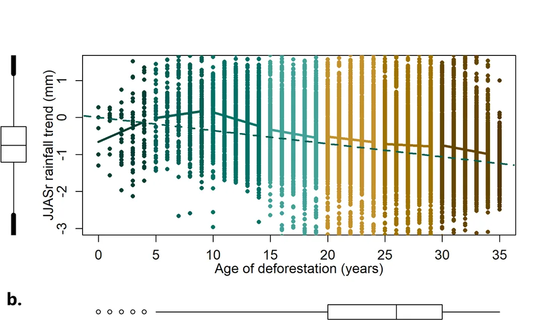
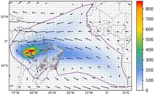
This study examines the impacts of three types of LLJs (Central, Northern, and Andes) on Mesoscale Convective Systems (MCSs), using a 4 km horizontal grid spacing Weather Research and Forecasting (WRF) model simulation and satellite-based data. The Central and Andes LLJ types facilitate significant moisture flux convergence over the La Plata Basin (LPB), contributing to intense MCS activity and heavy precipitation. In contrast, the Northern LLJ type, operating over the eastern slopes of the northern Andes, exerts a weaker impact on MCS development over the Amazon Basin, leading to more scattered convection. Stronger LLJs support larger, longer-lived MCSs with higher mean precipitation in jet exit regions. El Niño Southern Oscillation modulates these relationships, with El Niño increasing MCS size and duration in the Central LLJ region, while La Niña enhances MCS frequency in the Andes and Northern LLJ regions. The WRF model captures many of these dynamics but produces higher extreme MCS mean precipitation than IMERG. These findings highlight the importance of LLJ variability in modulating MCSs and suggest that future LLJ changes could alter the hydroclimate and extreme weather patterns in the region.
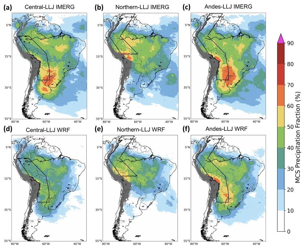
Fraction of MCS precipitation to total precipitation based on observations (top row), simulations (bottom row) for (a, d) Central LLJ, (b, e) Northern LLJ, and (c, f) Andes LLJ. The black box outlines the corresponding LLJ regions.
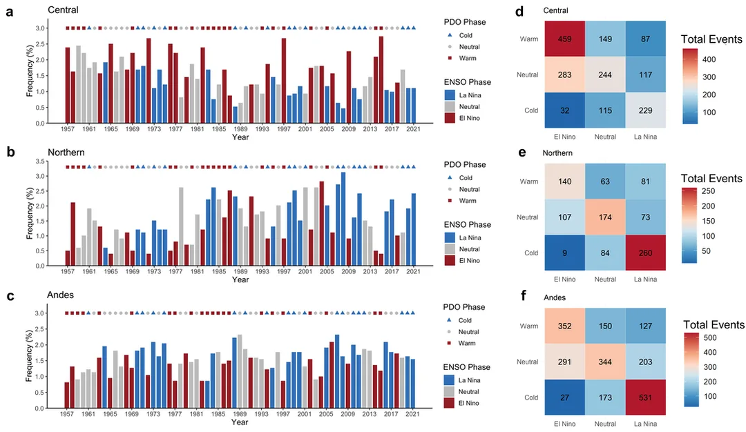
LLJ frequencies during ENSO and PDO phases. Annual frequencies (%) (DJF) of a Central, b Northern, and c Andes LLJ types during warm, neutral, and cold ENSO-PDO phases, and total events (days) for d Central, e Northern, and f Andes across all ENSO-PDO combinations.
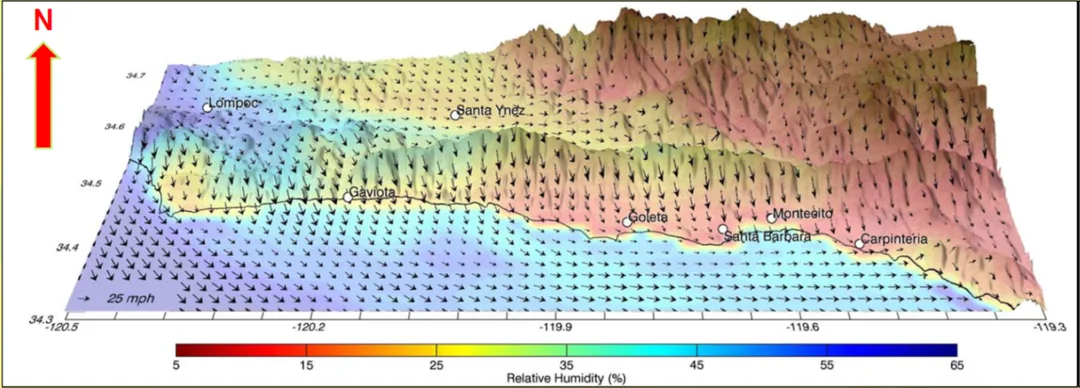
For more information of SWEX: www.eol.ucar.edu/field_projects/swex